Suru Valley -
One of the most beautiful regions of Ladakh, the Suru Valley is the heartland of Kargil district. Nestling along the northern foothills of the Great Himalayan Wall, it extends from Kargil town, first southward for a length of about 75 kms up to the expanse around Panikhar, and thence eastward for nearly 65 kms, up to the foot of the Penzila watershed, where the Suru River rises.
With its considerable tracts of alluvial floor and verdant hill slopes that are intensively cultivated by a hardworking peasantry, the Suru Valley serves as Ladakh’s granary. Its composite population of about 40,000 mainly of Tibeto-Dard descent, are mainly Muslims, their ancestors having been converted from Buddhism around the middle of the 16th century.
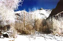
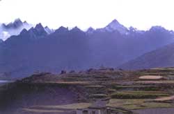
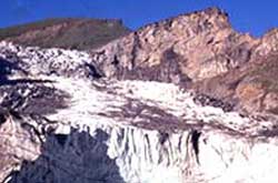
The upper reaches of the valley, particularly around the Sankoo bowl, the expanse around Panikhar and the higher stretches beyond, present a spectacle of breathtaking features - majestic mountain ranges crowned by snow-capped peaks, alpine slopes drained by wild mountain streams of pristine water, awesome glaciers descending along the Himalayan slopes to the river bed in impressive formations, quaint villages of adobe houses straggling dry hillocks, which are generally surrounded by cultivated fields and alpine pastures uphill. The area around Panikhar and further up is a veritable valley of flowers with a large variety of wild plants blossoming to spread a riot of colours during the months of June and July. The natural beauty of this area is heightened by the magnificent perspective provided by the towering peaks of Nun (7135 m) and Kun (7087 m), which loom over the skyline in their crystalline majesty.
Sightseeing in Suru Valley - The drive into the Suru Valley takes one through the picturesque and sprawling villages of Trespone area. Trespone (25 kms) is famous for its hilltop Imambara, which reflects a quaint mix of Islamic and Tibetan elements in its construction style and location.
It is also the place where the tradition of making a prototype of the ancient Scythian bow is still carried out by some families. This traditional bow is made from slivers of ibex horns glued to a central frame of mulberry wood, which being highly tensile and strong, is ideal suited for the purpose. There is high demand for these bows as they are used all over the region for the annual archery competitions held in almost very village of Kargil region during the period of the early spring.
Sankoo (42 kms), the next major expanse of the Suru Valley, is a picturesque township surrounded with numerous villages and colourful rocky mountains all around. Dense plantation of poplars, willows and wild roses fill the bowl-shaped valley, giving it the ambience of a man-made forest. Two side valleys drained by large tributary streams of the Suru River, the Kartse flowing from the east and the Nakpo-chu descending from the west, open up on either side of the expanse.
 |
|
The Kartse Valley runs deep into the eastern mountain mass with a number of isolated villages strung along its course. Kartse-Khar, an ancient village near the mouth of the valley, has a 7 m tall rock sculpture of the "Future Buddha", evidence of the passage of Buddhist missionaries through the region during the 7th to 8th centuries AD. The four-day trek from Sankoo to Mulbek follows this valley, the route passing through some very beautiful alpine areas on the way to the 4950 m high Rusi-La. The high altitude settlement of Safi with its mixed Buddhist-Muslim population is located between the Rusi-La and the Safi-La, over which the final leg of the trek passes, before descending into Mulbek. A southward route from the foot of the Rusi-La leads to Rangdum across the glacier - straddled Rangdum Pass where the Kartse River rises.
Sankoo is very popular among local picnic lovers, who throng the area from Kargil town and other places. Locally it is also popular as a place of pilgrimage to the shrine of a Muslim scholar-saint, Sayed Mir Hashim, who was specially invited from Kashmir for imparting religious teachings to the region's Buddhist ruler, Thi-Namgyal of the Suru principality, following his conversion to Islam during the 16th century. The shrine is situated in the village of Karpo-Khar on the outskirts of Sankoo, where the ruler had his summer palace.
Panikhar & Beyond - About 25 kms further ahead of Sankoo is Panikhar, lying under the shadows of the Nun-Kun massif. The first full photogenic view of Mt. Nun (7135 m), however, can be had from the roadside near the village of Thangbu, about 12 kms short of Panikhar. A beautiful expanse of the Suru Valley with about a dozen villages strung around, Panikhar comprises a series of intensively cultivated plateaux, descending in level steps, to the bed of the Suru River which here receives the gushing waters of Chelong River, one of its major Himalayan tributaries. During summer the area is converted into a veritable valley of flowers when a variety of alpine flora blossom, lending the region a colourful hue.
| |
 |
Panikhar is also a convenient base for the famous trans-Himalayan traverse between Ladakh and the Kashmir Valley. The shorter trek to Pahalgam via the Bhotkol Pass (4420 m), in the main range of the Himalayas, and the Gulol Pass, connecting the Warwan and the Lidder Valleys, takes about a week.
The trek to Kishtawar down the Warwan valley, or to Lehinwan in the Kashmir Valley, across the Margan Pass, takes longer. All these routes follow the lateral Chelong valley up to the Great Himalayan Wall where the Bhotkol Pass gives access to the headwaters of the Warwan Valley on the other side. Local peasant traders still use the route as do the Bakkarwal herdsmen for taking their flocks of sheep and goat across the Himalayan Range for grazing deep into its northern foothills.
 |
|
Panikhar is the base station for undertaking mountaineering expeditions to the various Himalayan peaks surrounding the valley. Tangol, the approach base for climbing Mt. Nun, is just 6 kms ahead of Panikhar on the roads to Zanskar. A short walk up the hill slopes from here takes one across the Sentik ridge to the base camp on the rim of the ice plateau. Another interesting hike starting from Panikhar, via Namsuru village, leads one along verdant hill slopes to Parkachik-La (3810 m) in the Parkachik ridge, in about 3 hours. From the top of the saddle-like pass, one can have a panoramic view of all the peaks in the Nun-Kun massif, alongwith its vast glacial plateau. From here one can retrace the way back to Panikhar in half the time or descend much faster to Parhachik village on the other side of the ridge. Near Parkachik is the majestic Parkachik Glacier, spilling down the Nun-Kun slopes, to collapse into the Suru River forming a huge icefall. One can walk up to the glacier across a good suspension footbridge over the Suru. Some mountaineers use this glacier to approach the difficult north face route to scale Mt. Nun. The upper Suru Valley also offers excellent camping options.
If one wanted to experience the ultimate thrill of camping under the very crest of the Great Himalayan Range, yet not without the safety of instant communication nearby, the upper Suru Valley around Tangol and Parkachik, may well conform to the idea of such a place. |
